Earth Observation Intelligence
for every industry
We are revolutionizing large-area observation with advanced high-altitude balloon technology, delivering critical insights from the stratosphere to support decision-making across diverse sectors and applications.
By the Numbers
600%
Higher quality than average satellite imagery
10×10 cm
5×5 cm if requested, for details
50%
Lower cost than existing monitoring methods
800km²
covered continuously with one device
10 min
Data latency after capture
600%
Higher quality than average satellite imagery
10×10 cm
5×5 cm if requested, for details
50%
Lower cost than existing monitoring methods
800km²
covered continuously with one device
10 min
Data latency after capture
Why Resoloon?
Drone
Limited altitude capabilityCan't fly higher than a few hundred meters
"Most drones can't fly higher than a few hundred meters. Most satellites can't see details smaller than 1 meter. Our balloon flies at 30000 meters - and sees this... And that's not even close to what we're aiming for."
Resoloon revolutionizes large-area monitoring with high-altitude balloon technology that delivers continuous, high-resolution imagery from the stratosphere.
Our system provides unprecedented visibility across diverse industries - from agriculture and insurance to disaster response and infrastructure monitoring.
Who We Serve & How
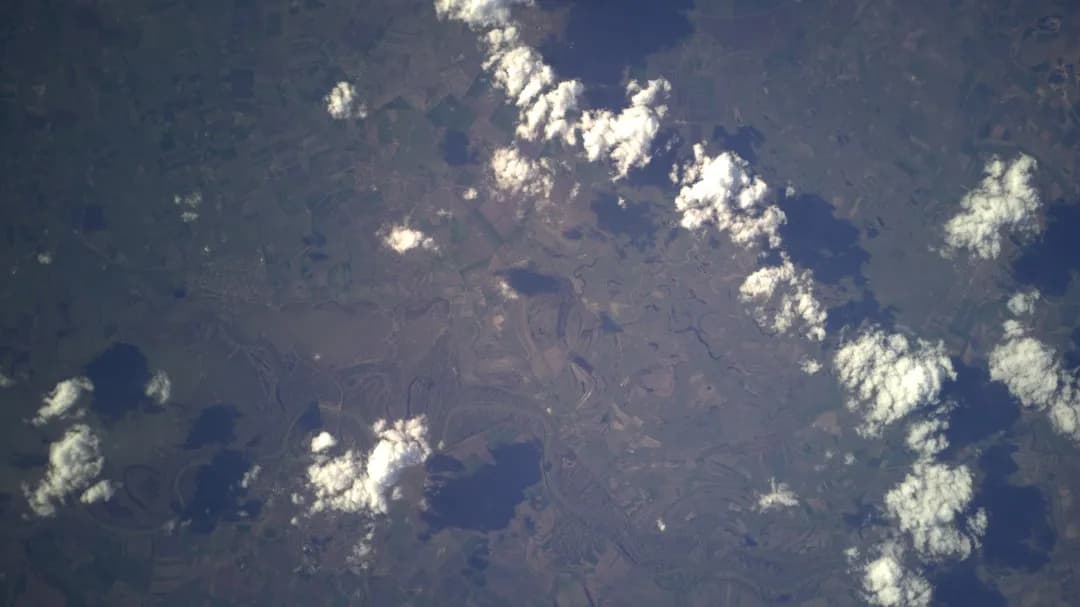
Lake Tisza captured from aerial observation
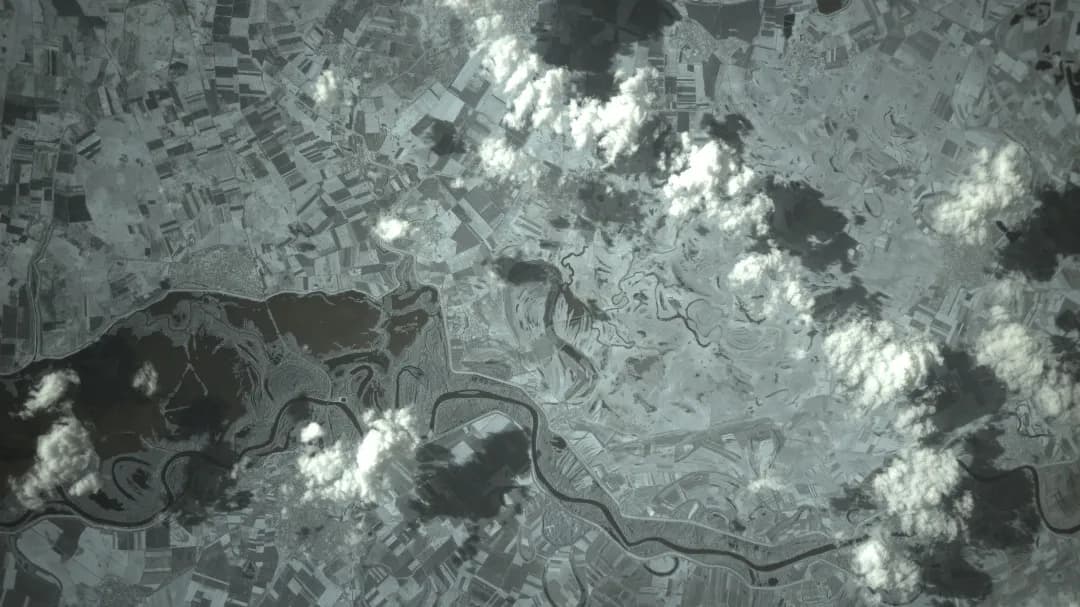
Infrared mapping highlights water bodies
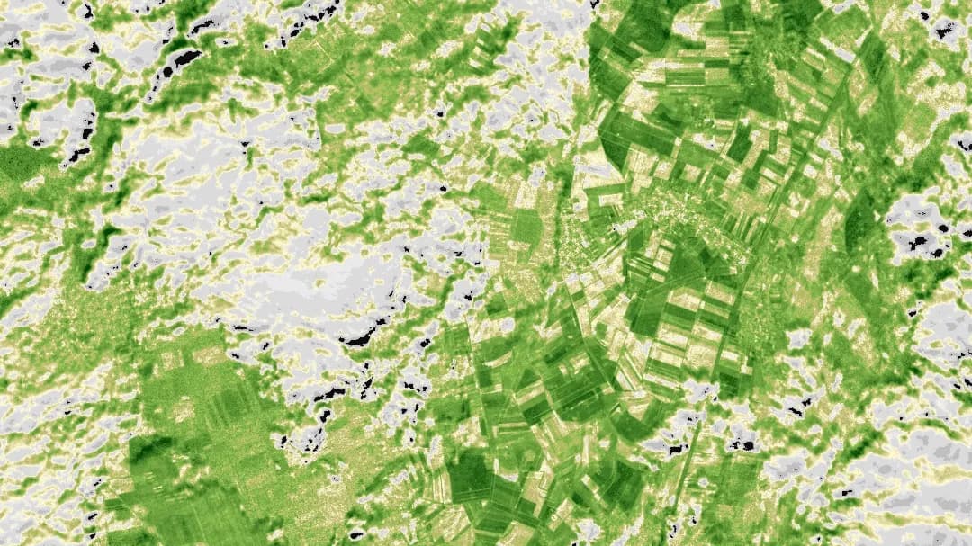
NDVI visualization for plant health
Cloud formations identified from aerial data
Cloud maps to analyze what actually matters
False-color analysis for clear data insights
GRVI crop health analysis
Lake Tisza captured from aerial observation
Infrared mapping highlights water bodies
NDVI visualization for plant health
Cloud formations identified from aerial data
Cloud maps to analyze what actually matters
False-color analysis for clear data insights
GRVI crop health analysis
Lake Tisza captured from aerial observation
Infrared mapping highlights water bodies
NDVI visualization for plant health
Cloud formations identified from aerial data
Cloud maps to analyze what actually matters
False-color analysis for clear data insights
GRVI crop health analysis
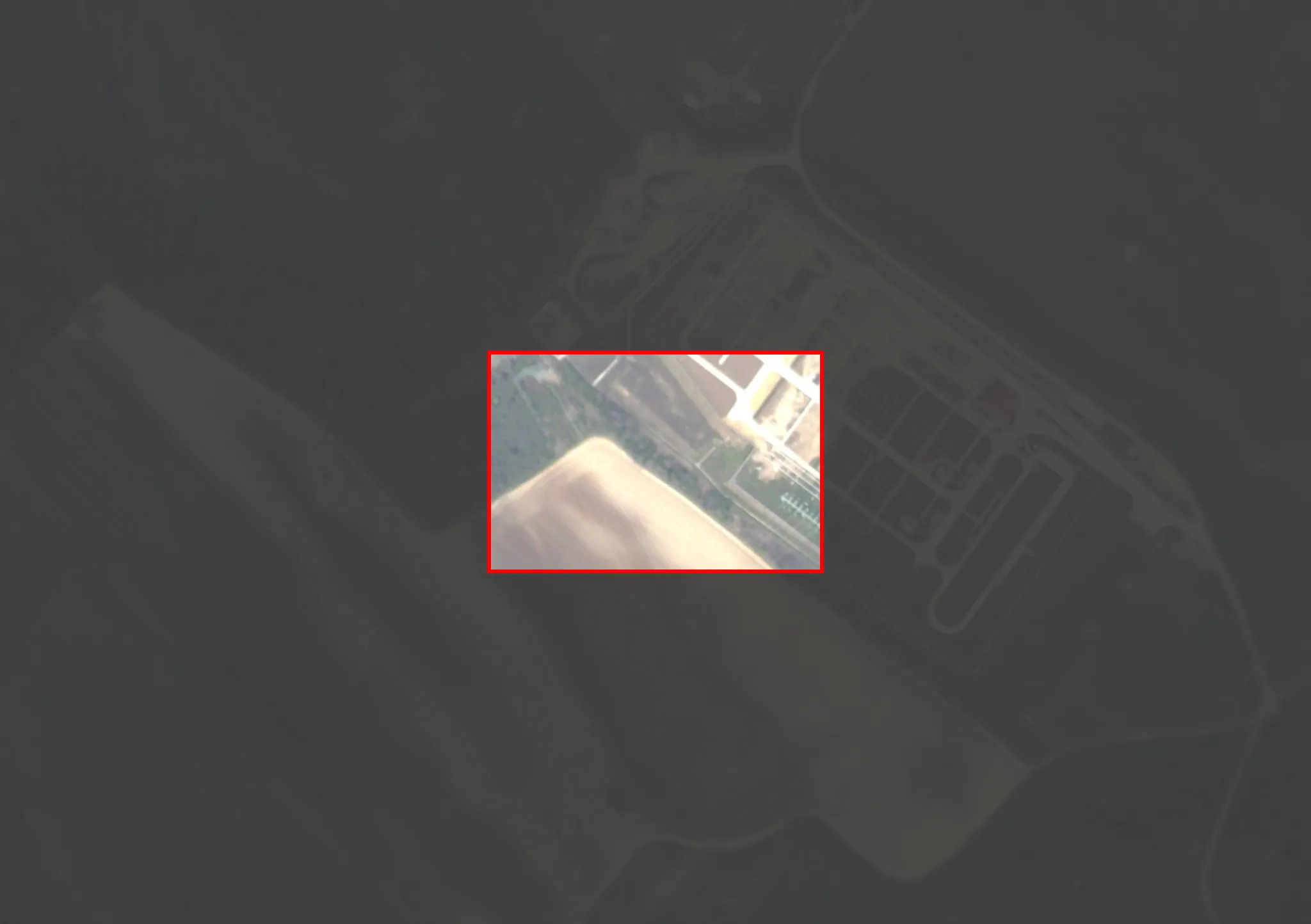
Villages north of Heves from above
NIR image reveals road networks

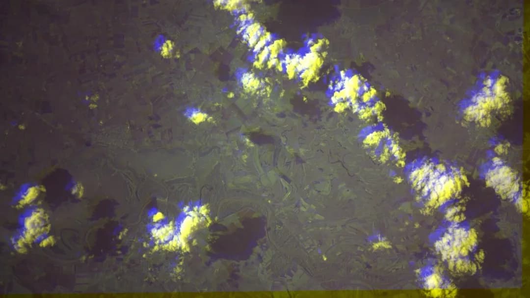
NDVI visualization for plant health
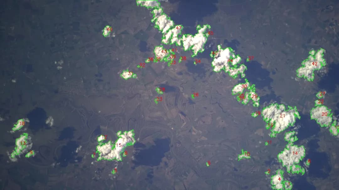
Clouds identified from aerial data

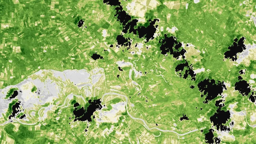
Cloud overlays improve analysis data

False-color imagery improves analysis
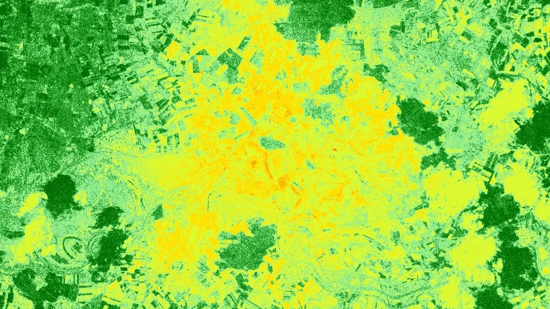
GRVI spectral plant insights
Villages north of Heves from above
NIR image reveals road networks
NDVI visualization for plant health
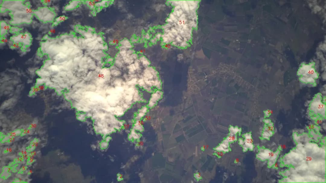
Clouds identified from aerial data
Cloud overlays improve analysis data
False-color imagery improves analysis
GRVI spectral plant insights
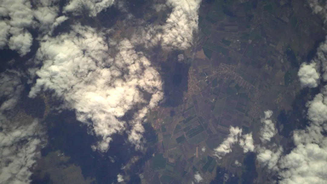
Villages north of Heves from above
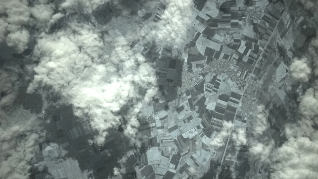
NIR image reveals road networks
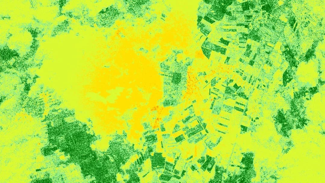
NDVI visualization for plant health
Clouds identified from aerial data
Cloud overlays improve analysis data
False-color imagery improves analysis
GRVI spectral plant insights
What We Offer
Resoloon offers a high-altitude balloon system capable of monitoring vast areas with unprecedented precision. Our system provides ultra-high-resolution images with a resolution of 10x10 cm, delivering approximately 600% higher quality than average satellite imagery across coverage areas up to 800km².
Ready to Transform Your Monitoring Capabilities?
Discover the power of stratospheric intelligence.
With Resoloon's advanced high-altitude imaging solutions, gain unprecedented insights that transform your operations across diverse sectors.